


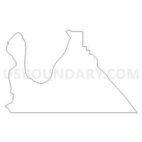
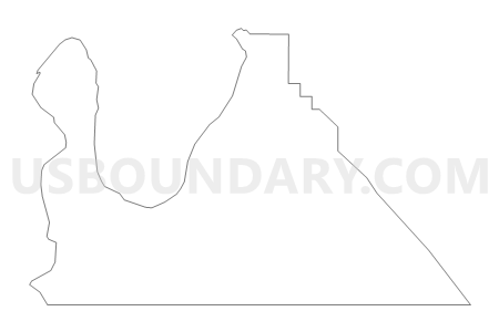
Moab 03 Voting District, Grand County, Utah
About
Outline
Summary
| Unique Area Identifier | 678852 |
| Name | Moab 03 Voting District |
| County | Grand County |
| State | Utah |
| Area (square miles) | 27.13 |
| Land Area (square miles) | 27.11 |
| Water Area (square miles) | 0.02 |
| % of Land Area | 99.92 |
| % of Water Area | 0.08 |
| Latitude of the Internal Point | 38.51418080 |
| Longtitude of the Internal Point | -109.57636270 |
Maps


Graphs
Select a template below for downloading or customizing gragh for Moab 03 Voting District, Grand County, Utah


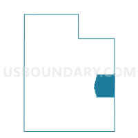
Neighbors
Neighoring Voting District (by Name) Neighboring Voting District on the Map
- La Sal Voting District, San Juan County, UT
- Moab 01 Voting District, Grand County, UT
- Moab 04 Voting District, Grand County, UT
- Moab 09 Voting District, Grand County, UT
- Moab 10 Voting District, Grand County, UT
- Moab 11 Voting District, Grand County, UT
- Spanish Valley Voting District, San Juan County, UT
Top 10 Neighboring County Subdivision (by Population) Neighboring County Subdivision on the Map
Top 10 Neighboring Place (by Population) Neighboring Place on the Map
Top 10 Neighboring Unified School District (by Population) Neighboring Unified School District on the Map
Top 10 Neighboring State Legislative District Lower Chamber (by Population) Neighboring State Legislative District Lower Chamber on the Map
Top 10 Neighboring State Legislative District Upper Chamber (by Population) Neighboring State Legislative District Upper Chamber on the Map
Top 10 Neighboring 111th Congressional District (by Population) Neighboring 111th Congressional District on the Map
Top 10 Neighboring Census Tract (by Population) Neighboring Census Tract on the Map
- Census Tract 3, Grand County, UT (4,833)
- Census Tract 2, Grand County, UT (4,392)
- Census Tract 9781, San Juan County, UT (3,773)